When GNSS Disappears: How OXTS and Hesai Lidar Keep Positioning on Track
A mapping vehicle enters a tunnel. A robot moves from an outdoor yard into a warehouse. A survey system passes between high-rise buildings. The environment changes in seconds, but one requirement does not: the system still needs to know where it is.
For positioning systems that rely heavily on satellite signals, these transitions create a fundamental challenge.
Global Navigation Satellite System (GNSS) signals can become weak, unreliable or unavailable inside tunnels, between tall buildings, under dense foliage and indoors. For mobile mapping, robotics and other positioning-critical applications, losing that reference can mean increasing localisation error, interrupted workflows or the need for reinitialisation.
OXTS and Hesai are addressing this challenge by bringing together three complementary sources of information: GNSS for global positioning, inertial navigation for continuous motion tracking, and lidar for a precise 3D reference of the surrounding environment.
Through the OXTS WayFinder family, these technologies work together to support localisation as systems move from open sky into environments where satellite signals can no longer be taken for granted.
When the sky is no longer visible
GNSS is highly effective when a receiver has a clear view of enough satellites.
Real-world operating environments are rarely that consistent.
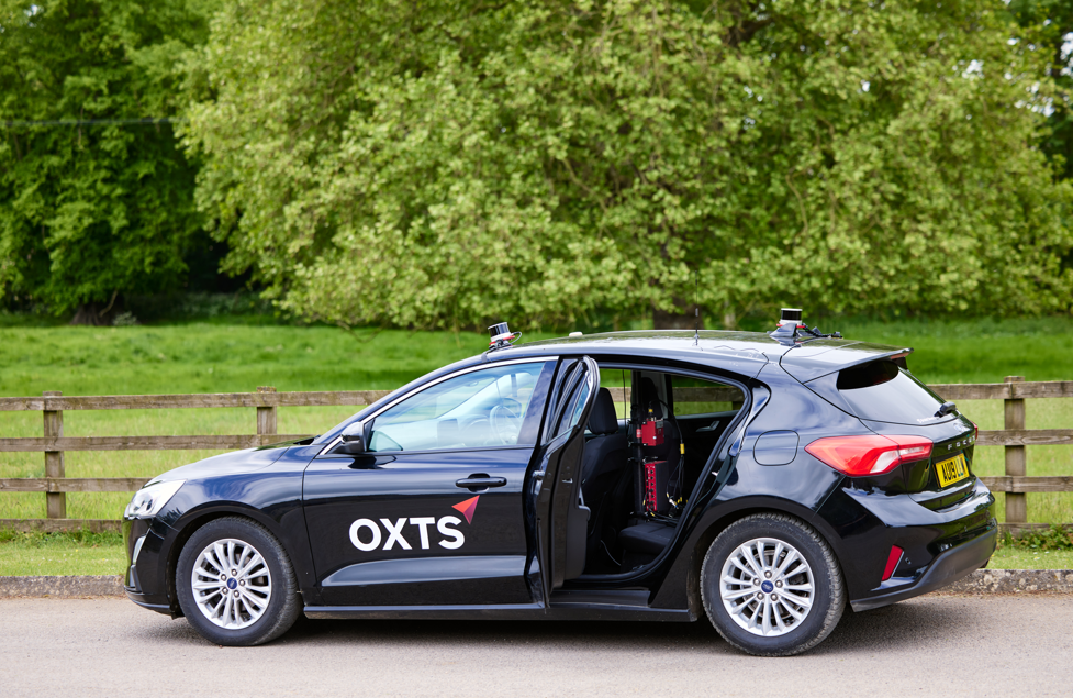
A vehicle may move from an open road into a tunnel. A robot can leave an outdoor loading area and enter a warehouse. A mapping platform may travel through a city where tall buildings obstruct or reflect satellite signals.
Techniques such as Real-Time Kinematic positioning, or RTK, can significantly improve GNSS accuracy when sufficient satellite information remains available. But they cannot remove the underlying dependency on satellite visibility.
An Inertial Navigation System (INS) provides another layer of information. Using measurements from an Inertial Measurement Unit (IMU), it continuously tracks acceleration and rotation and can continue estimating movement when GNSS becomes unavailable.
But small inertial measurement errors accumulate over time. Without an external reference to constrain them, the difference between the estimated position and the actual position can continue to grow.
Reliable localisation through a GNSS outage therefore requires another source of information.
Lidar turns the environment into a positioning reference
This is where lidar adds an important dimension.
Rather than looking upward for satellites, lidar measures the physical environment surrounding the system. It captures precise 3D geometry that can be used as environmental reference information for localisation.
Walls, buildings, tunnel structures and other physical features can therefore become part of the positioning process.
The principle is relatively simple:
- GNSS provides the global position reference when satellite signals are available.
- INS continuously tracks how the platform is moving.
- Lidar provides detailed 3D information about the environment around it.
The value comes from combining them.
WayFinder: Combining GNSS, INS and Hesai lidar
OXTS developed the WayFinder family to bring these positioning sources together within one system rather than requiring customers to build the complete integration themselves.
When GNSS is available, it provides the global reference. As satellite information becomes unreliable or disappears, the INS continues tracking movement while lidar-derived environmental information can help constrain the positioning estimate.
WayFinder Prime integrates the Hesai XT32M1X lidar, which OXTS also recommends for use with WayFinder Hub. Other Hesai lidar models may be used with WayFinder Hub but require additional testing and are not currently fully supported by OXTS.

How the sensor fusion works
| Component | Role in the positioning system | When it becomes particularly important |
| GNSS | Provides a global position reference | Open-sky environments with reliable satellite visibility |
| INS / IMU | Continuously measures motion and orientation | During transitions and temporary GNSS loss |
| Hesai XT32M1X lidar | Measures the surrounding environment in 3D | Where GNSS is degraded or unavailable |
| OXTS LiDAR Boost | Incorporates lidar-derived information into the GNSS/INS positioning solution | Maintaining localisation across changing environments |
The technical challenge is not simply collecting lidar data. The spatial information needs to be translated into something the positioning system can use continuously and in real time.
OXTS LiDAR Boost is designed to do this by using lidar-derived information to compensate for missing or erroneous GNSS updates within the OXTS positioning solution.
All data remains owned and controlled by the customer, with processing and storage handled within the customer’s own systems. Hesai does not store customer data.
“Our partnership with Hesai brings together high-precision positioning technology and advanced LiDAR capabilities to deliver accurate, reliable and efficient mobile mapping solutions through the WayFinder product family. We’ve worked closely with Hesai now for a number of years, and their technology was the obvious choice for this integration due to it’s ease of use and best in class ranging accuracy”
Stan McCarthy, Senior R&D Engineer – Navigation Software, OXTS
From open sky to real-world environments
The value of the integration becomes particularly clear in applications where GNSS conditions can change during a single operation.
For mobile mapping, a vehicle may move from open roads into tunnels or dense urban areas during the same capture run. Maintaining localisation through those transitions can help reduce interruptions and the need for manual reinitialisation.
OXTS has also put WayFinder Prime to work in a particularly challenging GNSS-denied environment, using the system to map inside a mine. The project provides a real-world example of the type of environment where satellite positioning cannot be relied on and additional localisation information becomes essential.
For autonomous navigation, robots and other mobile platforms may move between outdoor, covered and indoor environments while still requiring a continuous and reliable position estimate.
In industrial and logistics environments, buildings, covered areas and other infrastructure can interrupt satellite visibility even though positioning remains critical to the operation.
Across these applications, the challenge is the same: the environment changes, but the system still needs to know where it is.
By combining GNSS, inertial navigation and Hesai lidar, WayFinder gives the positioning system multiple sources of information to draw on as those conditions change.
Positioning beyond ideal conditions
GNSS availability can change within a single operation, but the need for reliable localisation does not. By combining GNSS, inertial navigation and Hesai lidar, OXTS WayFinder is designed to help systems maintain positioning across open-sky, covered and GNSS-denied environments.
As mapping platforms, robots and industrial systems move through increasingly complex environments, positioning will need to adapt with them rather than depend on ideal satellite conditions.
Frequently Asked Questions
What is GNSS-denied navigation?
GNSS-denied navigation refers to positioning in environments where satellite signals are unavailable or unreliable, such as tunnels, indoor spaces and dense urban environments.
How does lidar help when GNSS is unavailable?
Lidar measures the 3D geometry of the surrounding environment. Localisation algorithms can use information derived from those measurements as an additional reference to help constrain the position estimate when GNSS becomes degraded or unavailable.
Does lidar replace GNSS?
No. In WayFinder, lidar complements GNSS and inertial navigation. GNSS provides a global reference, the INS continuously tracks movement, and lidar adds information about the physical environment around the system.
What is OXTS WayFinder?
WayFinder is a family of OXTS positioning solutions that combines GNSS, inertial navigation and lidar-supported localisation for environments where GNSS availability can change.
What is the difference between WayFinder Prime and WayFinder Hub?
WayFinder Prime combines an OXTS INS with the Hesai XT32M1X lidar sensor in an integrated solution. WayFinder Hub enables lidar-supported localisation to be added to an existing OXTS INS setup. OXTS recommends the XT32M1X for WayFinder Hub; other Hesai lidar models require additional testing and are not currently fully supported.