From industrial logistics and agriculture to cleaning robots, drones, quadrupeds and humanoids, spatial perception is helping machines take on work beyond predictable environments.
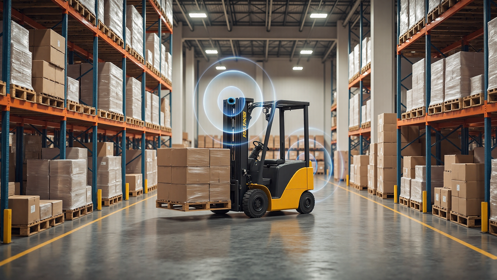
A warehouse robot may have a perfectly planned route, until someone leaves a pallet in its path. The destination has not changed, but the space around the robot has. To keep working, the machine needs to understand its surroundings as they are now, not just follow instructions based on how they looked earlier.
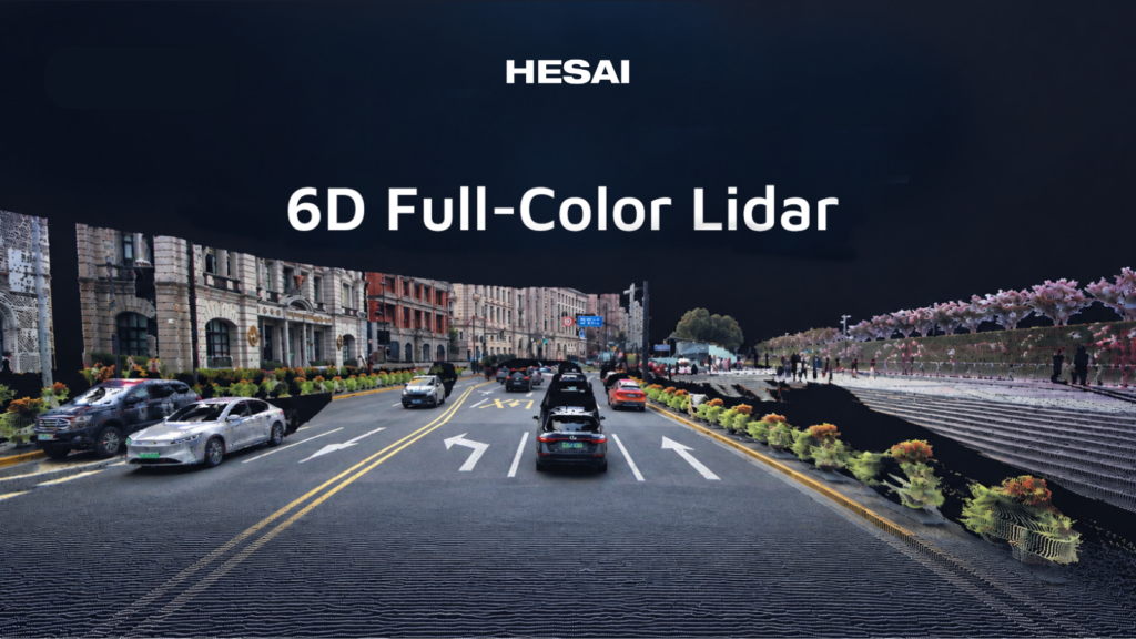
That challenge now stretches across robotics, from automated transport and agricultural machinery to compact household devices and robots that walk or fly. Lidar plays an important role by measuring distances to surrounding surfaces and creating a geometric view of the world. In three-dimensional (3D) systems, this information forms a point cloud that software can use to estimate position, detect obstacles and judge the space available for movement. Working alongside cameras, motion sensors and other technologies, lidar helps robots turn an understanding of their environment into action.
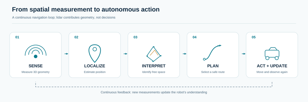
Figure 1. Lidar supplies measured geometry that navigation software can use to localize, plan and respond as the environment changes.
From moving goods to carrying out the job
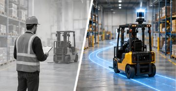
In logistics, autonomy is no longer limited to vehicles travelling between fixed points. Automated guided vehicles and autonomous mobile robots transport materials, robotic forklifts approach storage locations, and inventory platforms scan warehouse racks while moving through the aisles. Mobile manipulators combine travel with tasks such as picking or handling objects.
Each job calls on spatial perception differently. A transport robot needs to identify a newly blocked aisle and find usable space around it. A forklift must approach racks and pallets with enough clearance for its load. An inventory robot can use 3D measurements both to navigate and to record the layout of stock and shelving. In the same way, lidar can give a mobile manipulator a geometric reference as it approaches a work area, while cameras and closer-range sensors support the handling task itself.
The value is not simply reaching a destination. It is being able to adapt movement and positioning to the physical workspace, even when that workspace changes. Lidar can also contribute to simultaneous localization and mapping (SLAM),¹ allowing robots to estimate where they are while building or updating a map.
This ability to localize using the surrounding environment also reduces dependence on external positioning signals. Global Navigation Satellite System (GNSS) signals, including GPS, can be unavailable inside buildings and can be unreliable beneath dense tree cover. By using lidar measurements as a reference, often together with onboard motion sensors, robots can navigate without continuous satellite reception. This is particularly valuable for machines operating across indoor and outdoor environments.
When the work moves outdoors
A transport robot leaving a warehouse faces a different set of conditions. In an industrial yard, trailers may be parked in different places, a loading ramp may be partly occupied and temporary barriers may divert traffic. Satellite positioning can help locate the vehicle on the site, but it cannot tell the robot whether the gap beside a trailer is wide enough to pass. Lidar provides the local distance and shape measurements that help its navigation system make that assessment.
Fields and farms bring their own variations. A feeding robot travels through barns where animals or equipment may obstruct its route. In an orchard, a machine must steer between tree trunks, account for uneven ground and maintain its position beneath foliage that can interfere with satellite reception. For a weeding or spraying robot, cameras can help distinguish crops from weeds while lidar supplies the geometry needed to follow rows and avoid obstacles. The technologies serve the same task from different angles: knowing what needs attention and where the machine can move to act on it.
From commercial services to everyday life
The need to work in changing spaces is just as relevant in places shared with people. Cleaning robots in airports and hospitals navigate around chairs, trolleys and temporary obstructions; delivery robots must adjust to changing pedestrian routes. Lidar-based mapping and obstacle perception help these machines cover their assigned areas without depending on an entirely fixed layout.
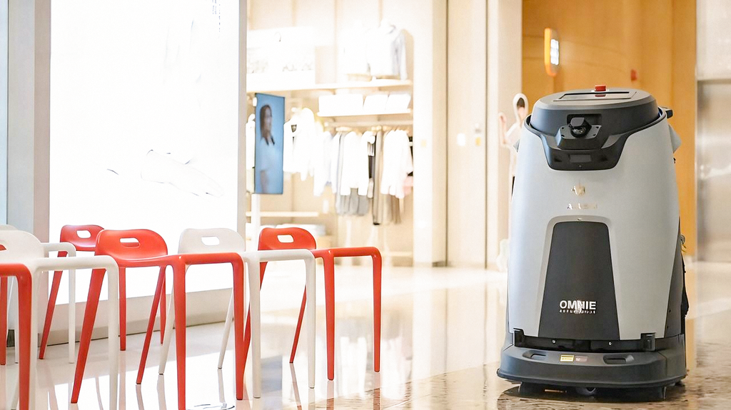
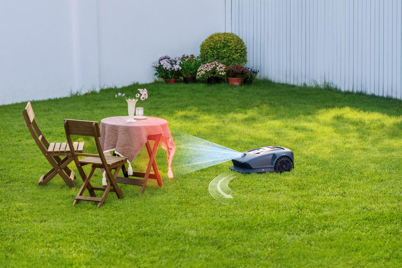
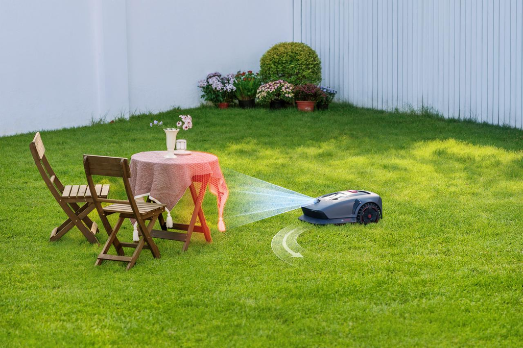
The same principles have entered homes and gardens. Lidar-equipped vacuum cleaners map rooms and plan systematic cleaning routes, while robotic lawn mowers can use spatial sensing to navigate around trees, garden furniture and narrow passages. What began as a practical tool for industrial automation is now part of smaller, high-volume products where size, power consumption and cost are crucial design considerations.
When robots move in three dimensions
So far, most of these machines travel across a floor or the ground. Drones, quadrupeds and humanoids introduce a different challenge: they must interpret the space above, below and around their bodies, not just the next stretch of a route.
An inspection drone entering a storage tank or industrial structure may have to fly around pipes and beams without satellite navigation. Lidar can provide 3D measurements for obstacle awareness and localization throughout the flight. A quadruped climbing stairs or crossing uneven terrain needs to recognize steps, edges and changes in height so its movement software can choose a viable path.
For humanoids, moving through a room may be only the first part of the job. Reaching for a shelf or opening a cabinet requires the robot to judge distances around its body and understand how much space is available for an arm to move. Lidar contributes that spatial geometry, while cameras help identify objects and joint sensors and touch feedback support coordinated movement. This is where perception begins to support physical interaction as directly as navigation.
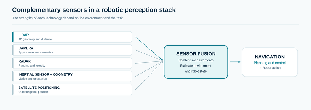
Figure 2. Lidar contributes 3D geometry and distance; cameras, positioning and motion sensors add information needed to understand the scene and control the robot.
Robotics lidar at a glance
The applications share a need for spatial awareness, but the most useful measurements differ according to what the machine is trying to do.
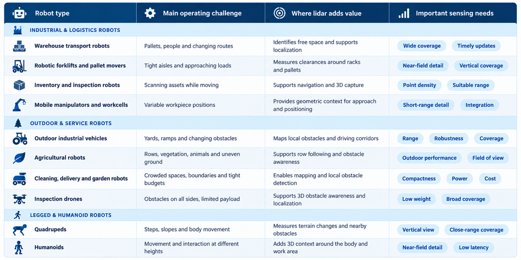
Note: Navigation and perception lidar is not automatically a certified protective device. Safety-related functions require an appropriately designed and validated system.
Outlook: from finding a path to getting work done
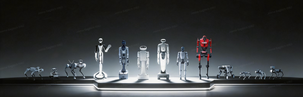
Across these applications, lidar plays an increasingly important role beyond navigation. In logistics, a robot must position itself accurately beside a load or adapt to a rearranged workspace. In agriculture, it must navigate around vegetation, animals and uneven ground. For quadrupeds and humanoids, spatial awareness also supports complex body movements and interaction with objects.
This connection between perception and physical action is central to Physical AI. Lidar provides precise 3D measurements of the surrounding environment, complementing cameras, motion sensors and intelligent control systems. As robots take on more sophisticated tasks in increasingly diverse environments, the ability to measure and understand physical space becomes even more valuable. Lidar is helping make that possible, extending its role from guiding robotic movement to supporting how machines interact with the world around them.
¹ Simultaneous localization and mapping (SLAM) is a method that lets a robot estimate its position while building or updating a map of its surroundings. Lidar provides geometric measurements for that process, often combined with motion information from other sensors.
FAQs
What is lidar used for in robotics?
Lidar measures the distances and shapes of nearby surfaces and objects. Robots use this spatial information for mapping, localization, obstacle detection and positioning, including tasks such as approaching a pallet or inspecting equipment.
Which types of robots use 3D lidar?
Applications include warehouse vehicles, robotic forklifts, inventory scanners, agricultural machines, cleaning robots, lawn mowers, inspection drones, quadrupeds and humanoids. Each category has different requirements for sensing range, coverage, size and power.
Why do robots use lidar and cameras together?
Lidar provides measured distance and geometry, while cameras help software identify objects and visual features. Together with motion sensors, these technologies help robots understand where objects are and how to respond to them.
Can lidar help robots navigate without GPS?
Yes. Lidar-based navigation allows suitably equipped robots to operate without continuous GPS or other satellite positioning signals. Using simultaneous localization and mapping (SLAM), robots can determine their position from surrounding structures while building or updating a map. Combined with onboard motion sensors, this supports autonomous navigation inside buildings, beneath trees and in other environments where satellite reception is unreliable or unavailable.
Why is 3D lidar useful for drones, quadrupeds and humanoid robots?
These machines must interpret space at different heights. Lidar helps drones detect surrounding structures, quadrupeds assess stairs and uneven ground, and humanoids measure nearby space when approaching or interacting with objects.