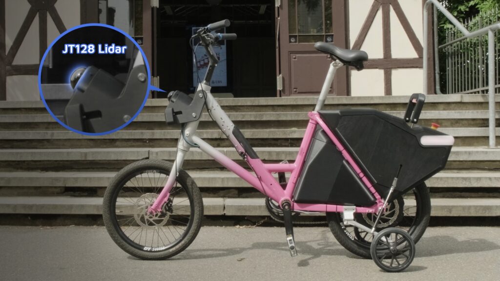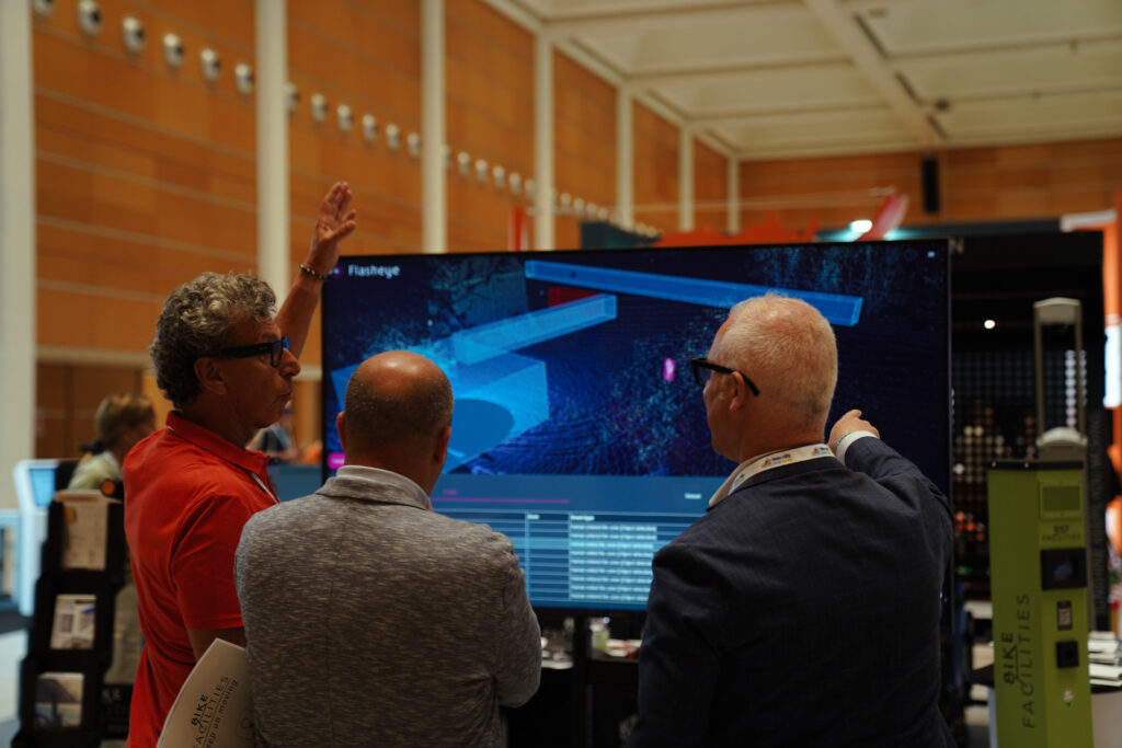
Lidar is increasingly used in robotics, autonomous systems, mapping, industrial automation and infrastructure applications. It gives machines a direct, three-dimensional understanding of the space around them.
For teams exploring lidar for the first time, the technology can raise practical questions. What does a lidar sensor see? How is it different from a camera or radar? Does it work in darkness and changing weather? What is a point cloud, and what is required to use the data?
The basic principle is straightforward. Lidar measures the distance to surrounding surfaces and combines those measurements into a precise 3D representation. Software can then use this information for navigation, mapping, localization, obstacle detection, measurement and movement analysis.
How does lidar work?
Lidar stands for light detection and ranging. A sensor emits laser pulses and measures how long the reflected light takes to return. Because the speed of light is known, it can calculate the distance to the surface that reflected each pulse.
Every measurement becomes a point in three-dimensional space. By repeating this process many times per second, the sensor builds a 3D representation known as a point cloud.
A point cloud can show:
- Where an object or surface is located
- How far away it is
- Its approximate shape and dimensions
- The structure of the surrounding environment
- How objects and positions change over time
The lidar provides the measurements. Connected software interprets them. A robot may use the data to identify free space and avoid obstacles, while a mapping system may use it to reconstruct a building or industrial site.
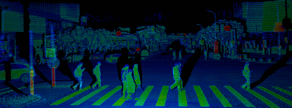
A lidar point cloud represents the surrounding environment through precise three-dimensional measurements.
What can lidar help a system do?
In robotics, lidar can support localization, mapping, route planning and obstacle detection. In reality capture, it can display buildings, infrastructure and terrain. In autonomous mobility and stationary applications, it can provide information about vehicles, people, materials and available space.
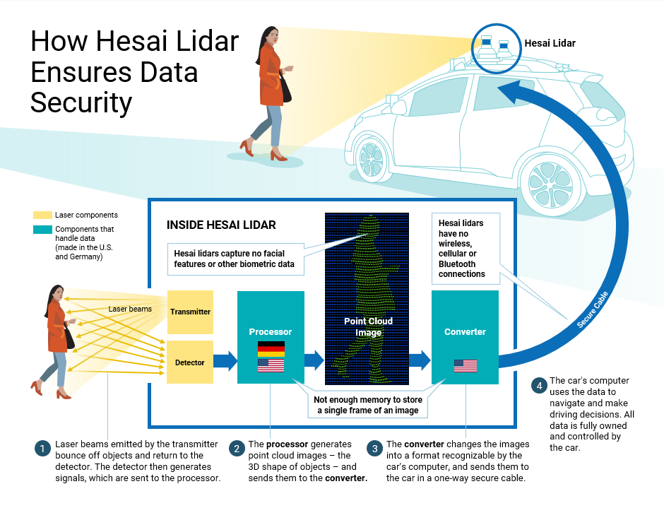
The lidar does not make operational decisions by itself. It provides the spatial data that the system uses. Hesai lidar sensors cannot store data or transmit it wirelessly. All data belongs to and is controlled by the customer.
How is lidar different from cameras and radar?
Lidar, cameras and radar provide different types of information and are often used together.
| Sensor | Main information |
| Camera | Color, texture, text, signs and visual appearance |
| Radar | Distance and relative velocity |
| Lidar | Direct 3D measurements of position, distance and shape |
A camera can help read a sign or recognize a color. Radar is useful when velocity information is important. Lidar shows where objects and surfaces are located and how much space is available around them.
For some systems, lidar provides the main spatial layer. In others, it works together with cameras, radar or additional sensors.
Does lidar work in darkness, sunlight and changing weather?
Yes. Lidar emits its own light and does not depend on daylight or artificial lighting. It can therefore perceive its surroundings in complete darkness.
Modern lidar is also designed for bright environments. Optical filtering, sensitive receivers and signal processing help separate reflected laser signals from strong ambient light.
Hesai lidar is designed to support reliable perception across changing weather and environmental conditions. Hesai’s Intelligent Point Cloud Engine, used in products such as the OT128 and ATX, identifies rain, fog, dust, exhaust fumes and water spray and filters environmental noise in real time. This capability as enables clearer, all-weather perception.
This allows lidar to support outdoor robots, autonomous vehicles, infrastructure applications and industrial systems that need to operate beyond controlled indoor environments.
Can lidar detect dark objects?
Yes. Lidar measures reflected laser light rather than relying on the visible color of an object.
Different surfaces reflect different amounts of light, which is why lidar range is often stated together with a reflectivity value. A specification such as “range at 10 percent reflectivity” provides useful context for relatively dark targets such as tires, dark clothing or asphalt.
When comparing sensors, the stated target reflectivity should therefore be considered together with the maximum range.
What information does a point cloud contain?
A conventional point cloud primarily represents geometry. It shows the position, distance and shape of surfaces rather than producing a conventional photograph.
Depending on the sensor and data format, individual points can also include information such as intensity, reflectivity and timestamps.
Software can then use this information to classify objects, reconstruct movement, measure changes or support navigation. The same point-cloud data could help a robot find free space, a mapping system reconstruct a room or an infrastructure platform analyze trajectories.
Can lidar also capture color?
Conventional lidar has primarily focused on geometry, while cameras provide color. This distinction is beginning to change.
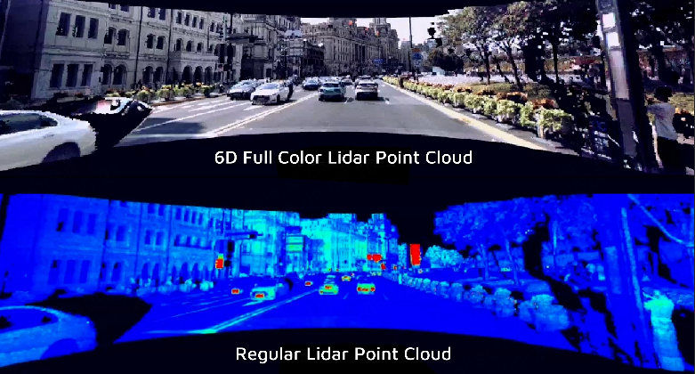
In April 2026, Hesai announced Picasso, a 6D full-color lidar SPAD-SoC that combines RGB sensing and time-of-flight ranging at chip level. The technology is designed to generate colorized point clouds directly, with spatial and color information closely aligned.
Hesai’s next-generation ETX platform is being developed around this architecture and is expected to enter mass production in the second half of 2026.
This brings precise 3D geometry and color information together within one sensing platform, providing richer environmental information for future autonomous systems and spatial applications.
Hesai’s announced full-color lidar technology combines 3D measurements with RGB information to generate colorized point clouds.
Does lidar identify people and objects?
A lidar sensor measures the geometry and position of surfaces. Object recognition and classification are normally performed by connected software.
The software can interpret a group of points as a person, vehicle, pallet, wall or another object, depending on the application.
This means the same lidar data can support different functions, including obstacle detection, localization, object classification and trajectory analysis.
Is lidar privacy-friendly?
Yes. Lidar is inherently privacy-friendly because it measures spatial information rather than capturing conventional images.
A lidar point cloud represents information such as the shape, distance, position and movement of objects. A conventional lidar does not capture facial features, identities or other personally identifiable visual details. This allows a system to detect a person or understand how people move through an environment without collecting personal or biometric information.
This makes lidar particularly suitable for applications in public spaces, infrastructure, robotics and industrial environments where reliable perception is required while protecting individual privacy.
For colorized point clouds, customers should assess applicable privacy requirements for their specific application.
Does a Hesai lidar store or wirelessly transmit data?
No. Hesai lidar sensors do not store point-cloud data.
The sensors have no mechanism for storing even a second of the data they capture. They also cannot transmit point-cloud data wirelessly because they have no cellular connection, Wi-Fi or Bluetooth.
Point-cloud data is transferred through a secure wired connection to the customer’s computing system. The customer retains ownership and control of the data and determines whether it is processed in real time, recorded or stored by the wider application.
The distinction is important: the lidar sensor generates and outputs point-cloud measurements, but it does not independently record, retain or wirelessly transmit them.
Is lidar safe to use around people?
Hesai lidar products are developed according to established laser-safety requirements. Hesai publishes Class 1 eye-safety status for models including the OT128, ATX and JT series.
Class 1 means that the laser is considered eye-safe under the product’s defined operating conditions.
As with any technical component, the sensor should be installed and operated according to the relevant product documentation.
What is the difference between rotating and solid-state lidar?
A rotating lidar uses moving scanning elements to provide broad horizontal coverage, often including a complete 360-degree view. This can suit robots, mapping platforms and stationary applications that need awareness in every direction.
A solid-state lidar covers a defined field of view without a continuously rotating external assembly. Its compact form can suit systems that need focused perception in a particular direction or zone.
Hybrid architectures also combine optical, electronic and mechanical elements.
No approach is automatically better. The right architecture depends on the required field of view, range, resolution, form factor and installation position.
What is required to integrate lidar?
A lidar sensor needs to be connected to the wider hardware and software system. Integration commonly includes:
- Selecting the mounting position
- Connecting power and data
- Installing the relevant driver or SDK
- Configuring and calibrating the sensor
- Processing and visualizing the point cloud
- Connecting the data to the application software
- Testing the complete system in its intended environment
Good development resources can simplify this process. Hesai provides product documentation, downloadable resources and point-cloud tools.
PandarView and PandarView 2 allow developers to visualize live point clouds on the customer’s system, record and replay data, inspect individual points and export selected data for further analysis.
How do you choose the right lidar?
The best starting point is the task the system needs to perform, not one headline specification.
Teams should define:
- What the system needs to perceive
- The required detection distances
- The necessary horizontal and vertical coverage
- Whether the application is indoors, outdoors or both
- The available installation space, weight and power
- The required level of detail and accuracy
- The speed of the platform
- The software and computing architecture
A compact indoor robot may prioritize close-range coverage and low power consumption. A mapping system may prioritize precision and consistent 360-degree data. A faster autonomous platform may require longer range and higher resolution.
The right lidar is the one that provides the spatial information the complete application needs.
From first questions to a working application
Lidar gives machines a direct way to measure and understand the physical world in three dimensions. It works independently of ambient light, supports all-weather perception and provides precise information about distance, position, shape and available space.
The technology can support anything from a service robot to an autonomous vehicle, mapping platform or stationary perception system. Developments such as full-color lidar are also expanding the information that a point cloud can provide.
Starting with the application makes it easier to identify the right field of view, range, resolution, form factor and integration approach.
To discuss how lidar could fit your application, contact the Hesai sales team.
Q&A
Does lidar work without GPS?
Yes. Lidar can support localization and mapping without GPS by comparing live point-cloud data with a map or by creating a map as the system moves. The exact approach depends on the localization or SLAM software.
Can lidar see through walls?
No. Lidar measures surfaces that its laser light can reach. It can map visible structures but does not see through solid walls.
Does lidar produce an image?
Lidar produces a 3D point cloud rather than a conventional photograph. The point cloud can be visualized and color-coded by distance, height, intensity or other values.
Hesai has also announced full-color lidar technology that adds RGB information directly to individual points.
Can lidar replace a camera?
Lidar provides precise distance and geometry. Cameras remain useful when an application needs color, text or detailed visual appearance.
Some systems use lidar as their main perception sensor, while others combine several sensor types.
What is the most important lidar specification?
There is no single specification that determines the best sensor.
Range, field of view, resolution, accuracy, point density, size, power consumption and environmental performance should be considered together based on the requirements of the application.